Jun 18 2010
Cabo San Lucas to Bahia Magdelena: The Longest Leg of the trip
Tuesday, 15 June 2010
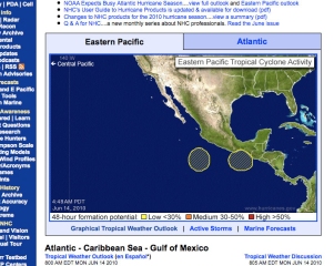
Out of the two storms, one of them faded, and the other has turned into a tropical storm (Tropical Storm Blas). Although it is moving at roughly 3 knots, it is heading towards Cabo San Lucas. Perhaps the water temperature in Cabo is cold enough to not have it turn into anything . . . which is exactly what I wish for my friends there.
As I was getting out of Dodge, so to speak, I had a rough start. The anchor was buried in over a foot of sand. We had been seeing some pretty amazing currents over the last few weeks, and well, I guess they decided to leave a ton of sand on top of the anchor.
The original plan was for me to pull anchor around 8am, get fuel and water, and set off to sea. It turned out that the anchor was stuck fast. So, I dove down to see if I had hooked some surprise (maybe another anchor? 😉 ) and to clear the problem. And, well, the problem was sand. Over the next 1.5 hours, I repeated the following as much as my body would allow: freedive down to the anchor in 25 feet of water, dig as much sand away as possible, and return to the top for air. It got a little frustrating because there were large southerly swells coming in to shore, and the current would send the sand right back to the neat little hole I had just carved out around the anchor. Finally, I dug out the sand enough to where I could muscle the anchor back up to the surface. This was about 2pm.
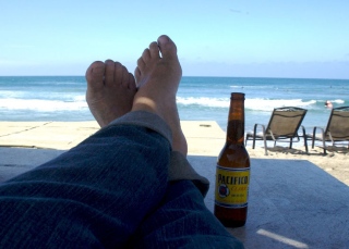
After the anchor was up, I pulled into the fuel dock, topped off the tank, filled 6 5-gallon jerry cans with diesel, hosed the boat down, and then filled every water-carrying vessel on-board. Oh, and I bought an ice cream to reward myself for diving and digging the anchor out of the sand.
It was now about 4:30pm–and, I was pretty exhausted. Instead of setting out for a 30-hour sail in this state, I reset the anchor in the far, southern end of the bay (as far from the jetskis as I could get), rechecked the weather, and slept–ready to get a good start in the morning.
Wednesday, 16 June 2010
I was up early–around 5am. Changed the engine oil first thing, and was sailing past the arch around 8:30am.
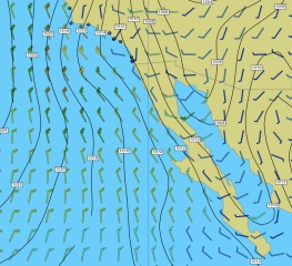
By the time I approached Cabo Falso, the winds were blowing 25 – 30 knots, and freshening by the minute. This area is a pinch point where the land meets many miles of open sea. Rather than bothering to put a 2nd reef in the mainsail, I simply dropped the sail altogether and lashed it to the boom.
Once safely around the point, I headed inland to follow the coastline for some protection from the wind and current, and the seas dropped nicely over the course of the day until reaching a cool 10 knots in the early evening.
This is the longest stretch of the trip at 152 Nm until the next protected anchorage, so I kept myself well rested, very hydrated, and eating small, healthy portions are regular intervals. Which was a good thing . . . because as the night progressed, the seas built to some nasty sailing. By 3am, the winds were back up to a steady 25 knots and the waves were a consistent 2 meters. It is what sailors call–lumpy conditions. 😉
Thursday, 17 June 2010
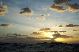
With the sunrise, the seas and wind laid back down, I was greeted by a spritely pod of dolphins (almost 30 of them came RACING towards the boat to greet me), and I pulled into Bahia Magdelena and set the anchor just south of Punta Belcher around 11am. I set everything out to dry, ate a little food, and slept.
Bahia Magdelena is very similar to San Francisco–without the bridge and the people, of course. Geographically, however, they are nearly identical. Punta Belcher also has a bit of history–in the late 1800’s and early 1900’s, it was a processing station for the whaling industry–Mag Bay is where the humpbacks come annually to give birth. Fortunately, the station has been closed for many, many years–but, the ruins are definitely interesting . . . .
The anchorage here is absolutely tranquil. One fishing trawler and a powerboat pulled into the anchorage to join myself and the other sailboat–and, other than a few pangas with fishermen, we are the only humans here. I didn’t realize how much noise and ruckus I lived around–with party boats, para-sailers, dozens of pangas, etc.–until, I heard a single bird cawing in the air. That was when I realized how quiet it is here . . . .
More later . . . .
Location:
24°34.408′ N
112°03.980′ W
PS. I have a lot of new pictures and video, but currently I could barely scrape together enough bandwidth to download the weather info. I’ll have better access in a few days.
