Archive for the 'Boats' Category

Jul 13 2010

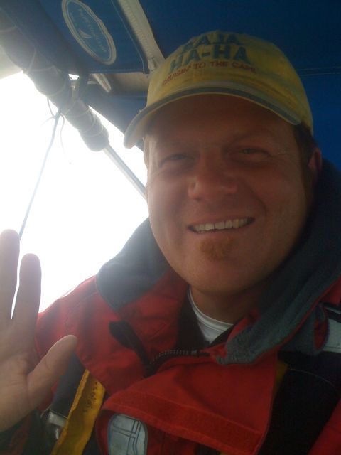
Sunny San Diego . . . .

Published by under Boats,The Adventure,Wylie 39

The last few legs were pretty amazing–the stretch from Turtle Bay to San Diego was filled with adventure, some really beautiful anchorages–and, some long miles. I will be posting more details of the trip in the next few days.

As for right now, I am in San Diego at the Transient Slips adjacent to the SD Police Docks. The sunshine has finally come out, and I am in the midst of all of the chandleries, harbors, marinas, and yacht clubs of San Diego. It is pretty amazing! (I even scored a ride on a Tripp 40 for the Wednesday night beer can races).

I’ll be here for a few more days to finish the repairs to Marishanna, and then I’ll be back at sea for the remaining legs to San Francisco. In the meantime, I have an internet connection and some work to finish . . . .

No responses yet

Jul 08 2010

Sailing over the US/Mexico Border

Just crossed the border. On my way to check back into the United States right now!

I’ll post the last few days adventures as soon as possible!

One response so far

Jun 29 2010

Change of Plans

Despite the nice sailing weather, I will be staying in Turtle Bay a few more days to do a little work and complete a project. I estimate my new departure date to be in a two or three more days–depending upon the weather.

4 responses so far

Jun 29 2010

Baja Bash: Departing Turtle Bay

I am departing Bahia de Tortugas as soon as Enrique can bring diesel and water. The route is to San Diego via: Isla Cedros, Punta San Carlos, Isla San Martin, Isla Todos Santos, and finally San Diego. Some of those places may not have cell phone or internet connection . . . . just so you know.

I’ll be back in the US soon!

No responses yet

Jun 24 2010

Baja Bash: Bahia de Asuncion to Bahia de Tortugas (June 24, 2010)

Around 3:45am, Marishanna and I were underway from Bahia de Asuncion to Bahia de Tortugas. We rounded the large islands and with almost no winds at all, made our way towards the open ocean and Turtle Bay.

There are two successive points that you have to pass, followed by a long, open bay (Bahia de San Cristobal). The northwest end of the bay has Thurloe Head with a small protected anchorage behind it, roughly an 8-mile rock outcropping and then the entrance to Turtle Bay. It is a straight-forward passage–with the exception of the fishing nets around San Pablo (the fisherman in Bahia San Hipolito warned me about them).

I was motor-sailing as the sun rose (6 – 8 knots of fluky wind was not enough to sail), and the further I got into the ocean, the stronger the seas built. Quickly, they were 2-meter waves every 2 – 3 seconds–a rough, pounding time and a bit more than lumpy, in my opinion. Shortly after, the fluky winds amplified to 15 – 20knots, and remained fluky–shifting as much as 20 degrees in the course of a few minutes.

I tinkered with the course a bit more, wanted to stay outside to avoid the fishing nets and the only course that balanced the waves and the wind was taking me WSW–away from Turtle Bay. So . . . I dropped the main sail, lashed it to the boom, and powered the rest of the way to Turtle Bay. It was quite a difference from the full sail of yesterday.

The seas stayed a bit more than lumpy and the winds stayed above 20knots all day, but landfall happened quickly, and I was sitting on the hook by 1pm. Also, while in Bahia de San Cristobal, I saw the spouts of three whales. They never breeched, but they were there . . . .

Turtle Bay is a large stopping point for boats on their way either up or down the Baja outside passage (there are more than a dozen boats here now). Clean diesel and potable water are available here (they actually bring it right to the boat), and there is a small town as well where you can re-provision, get warm showers, and a cold beer. There are cell phone signals here, too–and, internet access.

I also needed a few small repair parts for the boat–a spare belt for the engine and some fuses–which I was able to obtain pretty easily. I will be here for a few days to do some minor repairs on Marishanna, re-provision, buy diesel and water, and to get some current weather information.

And, then–it is the final 350Nm to San Diego and home . . . .

Location:
27°41.080′ N
114°53.317′ W

No responses yet

Jun 23 2010

Baja Bash: Bahia San Hipolito to Bahia de Asuncion (June 23, 2010)

The sail today from Bahia San Hipolito to Bahia de Asuncion is a short one–a bit longer than 20Nm. So far, I have been either motoring or motor sailing the entire distance. Today, however, I wanted to try full sail into the wind to see how it affects the speed of the transit, and because of the short distance, I could sail all day and still make it the next landfall in daylight. And, well . . . it was brilliant.

Marishanna’s pedigree is really shining on this trip. She is a fast boat. With her 5’6″ headroom, no noise or temperature insulation, and missing necessities for cruising, she excels in one area–speed. Under sail in a a breeze that freshened all day to a steady 22knots, Marishanna sailed a steady 6.5knots.

Bahia de Asuncion is a fairly large, well-protected anchorage, and there were 8 other boats anchored in the bay. On the far West side, there is an rock island with a couple that lives on it–and, a huge colony of sea lions, pelicans and other birds and healthy kelp beds surrounding it. Although it may be possible to travel between the island and the shore, it is shallow and not recommended except with local knowledge.

When I pulled into Bahia de Asuncion, I saw that my very, very good friends Ryan and Kristina on Caramello (think apple pie . . . . ) were already at anchor and on shore, and I anchored in 25 feet of water about 200 yards behind them.

All in all, the day and the experiment were both a success: I did not lose a significant amount of time under full sail, used zero diesel along the way, and had the beautiful, quiet, blissful experience of sailing that hooked me in the first place–all while returning the boat any myself safely to California . . . .

Later in the evening, I spoke with Ryan and Kristina from Caramello and without the internet access, I have been without fresh weather information (still tinkering around with the SSB radio). My weather info is about 5 days old. They had fresh information and were leaving at 10pm to sail the flat seas and relatively small winds to make the final 50 miles to Bahia de Tortugas.

I liked the idea of joining them, but had just set the anchor at 3pm, and would need some rest before an overnight passage. So, I opted to follow them in the early morning, rather than through the night.

They also loaned me two jerry cans of diesel fuel–because I still do not have access to the bottom 75% of the fuel tank because of the lifting pump problem.

Location:
27°08.068′ N
114°13.473′ W

No responses yet

Jun 22 2010

Baja Bash: Punta Abreojos to Bahia San Hipolito (June 22, 2010)

I awoke early, and took a long morning. I would either be sailing 40Nm to Bahia Asuncion, or stopping along the way at Bahia San Hipolito if the conditions were really big. That gave me a little time to enjoy the morning.

Right around the boat, a pod of dolphins were playing or feeding–regardless, they came right up to the boat and said Hi. In the meantime, I made a nice breakfast and some coffee and lingered over it while doing a little writing. It was a great morning.

Leaving Punta Abreojos is a bit tricky. There are two underwater knolls that under the right conditions can cause breaking waves out of seemingly open ocean. So, where you normally steer a wide course around the point and the breaking waves on shore, you need to steer close to the shore in this instance. Just outside of the breaking waves, and inside of the knolls. Needless to say, I hand-steered, poked my way through the main anchorage close to town, around the point and up the North side of the anchorage.

Last night, I was unable to see the town, but as I motored past it today, it looked cute. Larger than a village–with some amenities. A restaurant, a Pemex gas station, and the police station were all visible from the water. On the point, there was a small lighthouse.

On the way North, you stick along the inside track of the land following the 5-fathom depth curve. On the left, after 3 – 4 Nm up the coast, there is actually an outcropping of rocks–Roca de Ballena. It is named because it looks like open ocean because at high tide, you can barely see the rocks at all–maybe a foot or so out of the water. When a wave hits it . . . you can see what looks like a water spout of a whale.

After I passed that (and before the shoal of the Lagoon entrance ahead), I headed away from land and out to sea. Not long after I left the protection of the land, the wind built quickly to 25 – 30 knots. It is a familiar pattern of weather around here: calm at night, 5 – 10 knots in the morning and building, and by 1 or 2pm–blowing like stink–25 – 30 knots. Fortunately, Bahia San Hipolito was pretty close.

The town of Bahia San Hipolito was really small–there were only a few fishing pangas and perhaps three dozen houses–all built into the lee side of the small bluff. It looked pretty impoverished–but, the sun was setting and I was glad to be off the ocean and at anchor–even though it was still blowing 25 knots at anchor . . . .

Location:
26°58.984’N
113&deg58.466′ W

No responses yet

Jun 21 2010

Baja Bash: Bahia San Juanico to Punta Abreojos (June 21, 2010)

Got up early, pulled the anchor and set off for Punta Abreojos. Abreojos translates to “open eyes” because there are lots of hidden underwater nasties to catch, grab and sink your boat. The word is to NEVER make an entrance of this harbor at night or in poor visibility.

Marishanna and I made pretty good time on the way, and the breeze was relatively light–starting at 15 – 20 knots and freshening to about 25 knots–a typical day of summer sailing in San Francisco.

After eating all of the sushi from the last tuna, I decided to fish a little more. After 45 minutes with the cedar plug out on the line, I caught another Blue Fin Tuna–this time about 8 pounds.

As the afternoon progressed, the winds built to 25 knots of steady wind and the seas built to 1.5 – 2 meters–but the frequency increased to every 2 seconds. It was rough going, and I was happy to finally pull into Punta Abreojos. Because of the underwater hazards and I was rapidly losing sunlight, I approached the anchorage from the far Eastern side of the bay–well clear of the hazards.

I found a nice place to anchor in about 25 feet of water right around dusk, and watched the moon rise as I cooked dinner. Another really awesome day!

Location:
26°45.598′ N
113°30.820′ W

No responses yet

Jun 20 2010

Baja Bash: Bahia San Juanica (Part 2) June 20, 2010

Published by under Lido 14,Mexico,The Adventure

I pulled anchor around 7:30am and headed for the next stop at Punta Abreojos. On my way out of the anchorage, another sailboat was on their way into the port and they hailed me on the radio–asking if I knew where the panga fisherman met boats for fuel.

Fuel, I asked? With the possible problem with the fuel lifting pump, I wanted to purchase some extra fuel so that I could continue to run off the top of the tank.

He said that a fisherman offered to bring him diesel fuel, and I wanted that too, so I turned around and went back to the waiting area. After another 45 minutes, the fisherman arrived. He was charging 15 pesos per liter (about 6 pesos more than the price at the marina in Cabo San Lucas), but I bargained with him for a 5-gallon jerry can for 10 pesos a liter.

What we didn’t know is that he was going to wait until his afternoon/evening fishing session to return with the diesel–which was about 4:30, and far too late for me to depart for Punta Abreojos–which absolutely requires a daylight approach for all of the submerged dangers.

In the meantime, the other boat and I had rafted together, were well into telling stories, they treated me to a fine pork chop dinner, and loaned me some DVD movies for the evening–and, I shared my charts and guidebooks with them. Theirs were a bit outdated.

During the day, a couple of locals came sailing up in a 14-foot NY Long boat. It was all wood, had the sailing rig attached (it is basically the design of row boat that they used in NY harbor in the late 1800s–with an optional sailing rig). The return line for lifting the keel had slipped through and the centerboard was stuck in the down position. So, they tied up to Marishanna, I loaned them some snorkeling gear, and Christian dove below to retrieve it. Afterwards, we offered them some beers and to come aboard.

Turns out . . . that Bahia San Juanico is a hidden gem of a town with a healthy ex-patriot community of surf/sail loving Americans. According to Christian, they have three restaurants at night, one during the day, a grocery store, a Sailboat/Surfboard designer (Choate), and some really great long-board surf–two really long pipes that I saw. Unfortunately, they have no cell phone service.

And, I must admit the bay was filled with surfers, stand-up paddle-boarders, kayakers, etc. It was quite beautiful, and definitely a place I want to return and stay awhile.

Position:
26°15.083′ N
112°28.249’W

No responses yet

Jun 19 2010

Baja Bash: Bahia Santa Maria to Bahia San Juanico (June 19, 2010)

Bahia Santa Maria to Bahia San Juanico

I awoke around 4am, and actually had overslept a bit. The passage from Bahia Santa Maria to Bahia San Juanico is 95Nm–about 15 hours of sailing, and I wanted to arrive during daylight. So, I hurriedly, got dressed weighed anchor, and got on my way.

Over the night, the bay had calmed completely. The wind instruments were reading 0 knots of wind, and the water was glassy. As I steered a wide course around the point (most of the points have submerged rocks up to a half mile or more away from them), the wind picked up to a tiny 5 – 8 knots, and I proceeded on my way.

The stretch of land between the two bays has three water-filled lagoons–none of which I would attempt to enter in a boat with a keel. Perhaps a panga, or a sailing dinghy with a retractable centerboard, but certainly not this boat. And, setting a straight line course to Bahia San Juanico is the shortest route. The land curves a good distance away from that route.

Over the course of the day, the winds grew steadily to a meager 15 knots, and it was a fairly uneventful and relaxing (though long) sail. We like them that way. I did, however, drag the magical cedar plug on the end of the fishing pole behind the boat for about two hours and caught a 5-pound blue-fin tuna. I made sushi and put enough in the refrigerator for 2 more sushi servings.

On the final approach, Bahia San Juanico is an easy anchorage. You sail into the big nook on the East side of the bay, and far out in the center, I set the anchor in 18-feet of water. There was still some wind from the day, but the Punta Pequena protects the anchorage enough from the swell that there was no swell at all. And, into the night, the wind even died down. It was a very comfortable anchorage.

In the middle of the night, I got up around 4am and took a quick survey of the boat, and it was beautiful. The water is filled with plankton and with phosphorescence. At first, I looked up and saw that the relative darkness of this sparsely populated area allows for a REALLY good star-show. It was beautiful. When I looked down into the water, I saw something else. The phosphorescence was thick enough that it turned the darting fish into glowing, underwater silhouettes. It was quite a site to see the shapes of the fish, glowing green, darting through the water (NO–this was not an acid trip). 😉

When I was here, the water was a red color–from the red tide, so be careful not to catch and eat any of the fish in the water. Although, I always prefer to catch fish out in the open ocean because the water is simply cleaner . . . .

Position:
26°15.083′ N
112°28.249’W
No responses yet

« Prev - Next »